Map - Nantou County (Nantou)

Nantou County (Nantou)
Nantou County (Hokkien POJ: Lâm-tâu-koān; Hakka PFS: Nàm-thèu-yen) is the second largest county of Taiwan by area, located in the central part of the country. It is also the only non-coastal county in Taiwan. Its name derives from the Hoanya Taiwanese aboriginal word Ramtau.

Its mountainous area makes it a tourist destination; Sun Moon Lake is located in this county. Other well-known sightseeing of the county including Aowanda, Formosan Aboriginal Culture Village, Hehuanshan, Paper Dome, Qingjing Farm, Shanlinxi, Shuiyuan Suspension Bridge and Xitou. Notable cities in Nantou are Nantou City and Puli Town. The official butterfly of Nantou County is the broad-tailed swallowtail butterfly (Agehana maraho). Nantou's tung-ting tea is one of the most famous and high-quality oolong teas grown in Taiwan.

 
Map - Nantou County (Nantou)
Map
Google Earth - Map - Nantou County
Google Earth
Openstreetmap - Map - Nantou County
Openstreetmap
Map - Nantou County - Esri.WorldImagery
Esri.WorldImagery
Map - Nantou County - Esri.WorldStreetMap
Esri.WorldStreetMap
Map - Nantou County - OpenStreetMap.Mapnik
OpenStreetMap.Mapnik
Map - Nantou County - OpenStreetMap.HOT
OpenStreetMap.HOT
Map - Nantou County - OpenTopoMap
OpenTopoMap
Map - Nantou County - CartoDB.Positron
CartoDB.Positron
Map - Nantou County - CartoDB.Voyager
CartoDB.Voyager
Map - Nantou County - OpenMapSurfer.Roads
OpenMapSurfer.Roads
Map - Nantou County - Esri.WorldTopoMap
Esri.WorldTopoMap
Map - Nantou County - Stamen.TonerLite
Stamen.TonerLite
Country - Taiwan
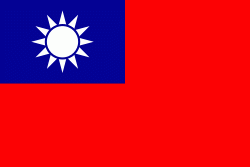
Flag of Taiwan
Taiwan, officially the Republic of China (ROC), is a country Multiple sources:

* in East Asia. It is located at the junction of the East and South China Seas in the northwestern Pacific Ocean, with the People's Republic of China (PRC) to the northwest, Japan to the northeast, and the Philippines to the south. The territories controlled by the ROC consist of 168 islands, with a combined area of 36193 km2. The main island of Taiwan, also known as Formosa, has an area of 35,808 km2, with mountain ranges dominating the eastern two-thirds and plains in the western third, where its highly urbanised population is concentrated. The capital, Taipei, forms along with New Taipei City and Keelung the largest metropolitan area of Taiwan. Other major cities include Taoyuan, Taichung, Tainan, and Kaohsiung. With around 23.9 million inhabitants, Taiwan is among the most densely populated countries in the world.
Currency / Language  
ISO Currency Symbol Significant figures
TWD New Taiwan dollar $ 2
ISO Language
ZH Chinese language
Neighbourhood - Country  
Administrative Subdivision
Country, State, Region,...